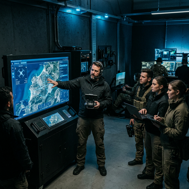
Where IndustryMeets Altitude.
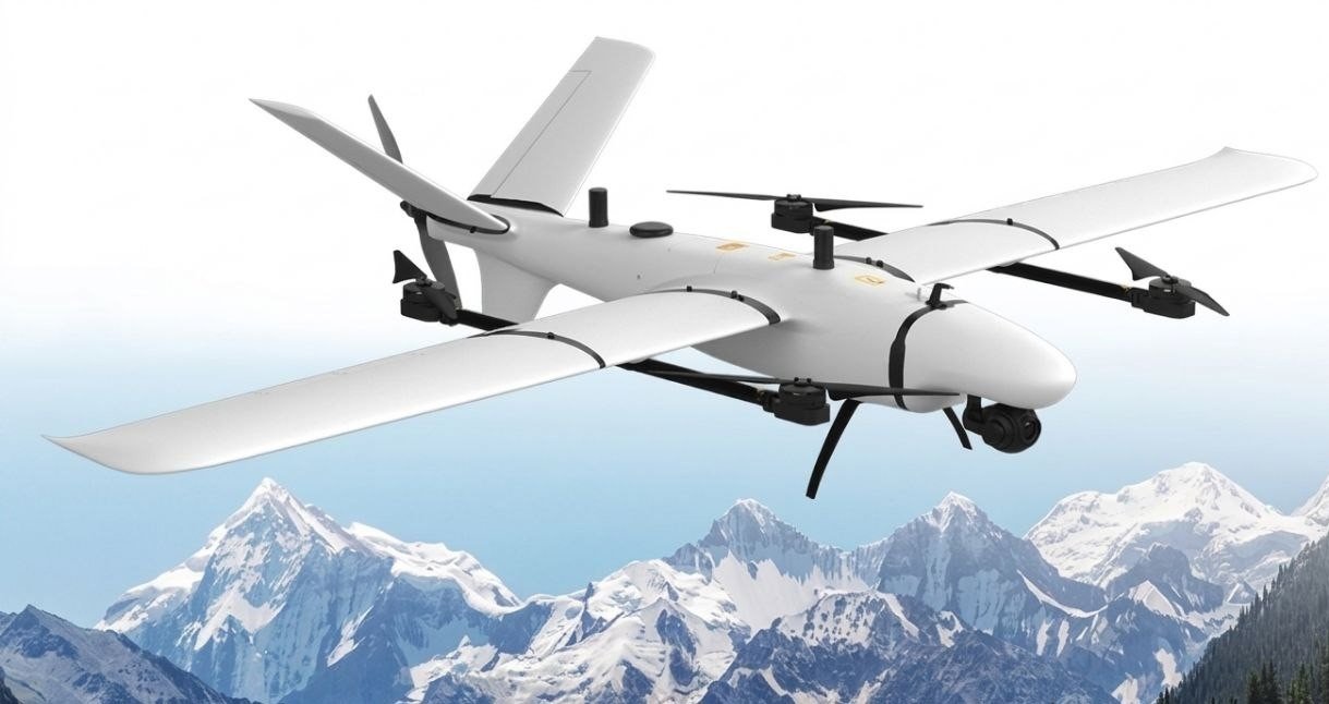
Aerial Technology engineers heavy-lift industrial and long-range survey drone systems for the world's most demanding operations — delivering precision and scale where it matters most.
Built for the
Industries That
Cannot Fail.
Every deployment is mission-critical. We engineer solutions for environments where precision is non-negotiable — from vast agricultural plains to remote mountain infrastructure.
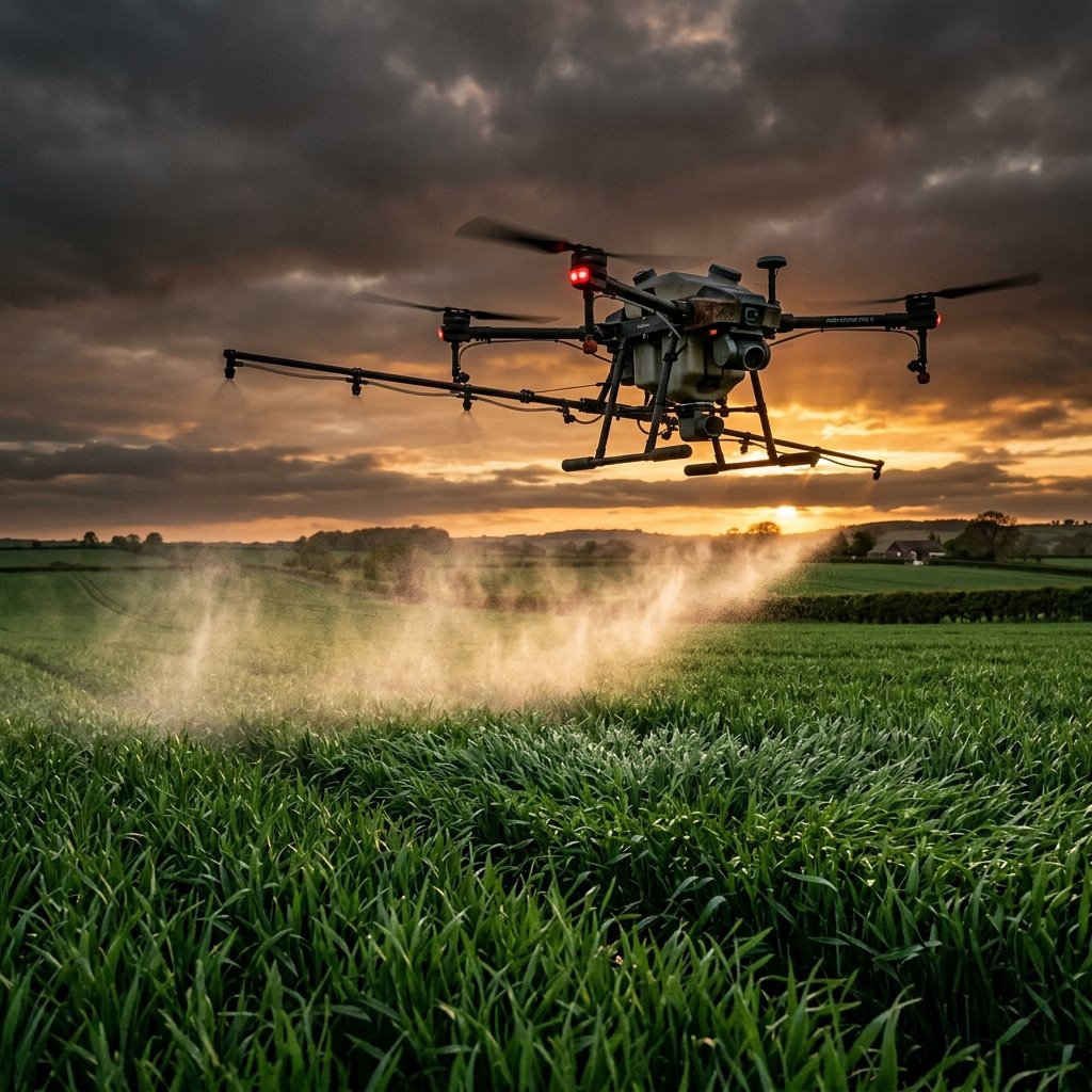
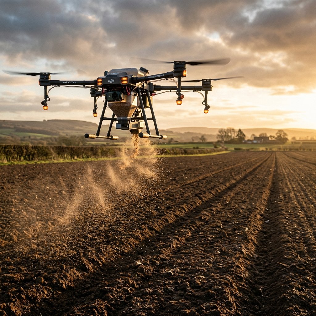
Precision Agriculture
30L liquid spraying and 40L granular spreading at scale — the Aerial Cart 30 reduces input costs while maximizing yields in complex terrain.
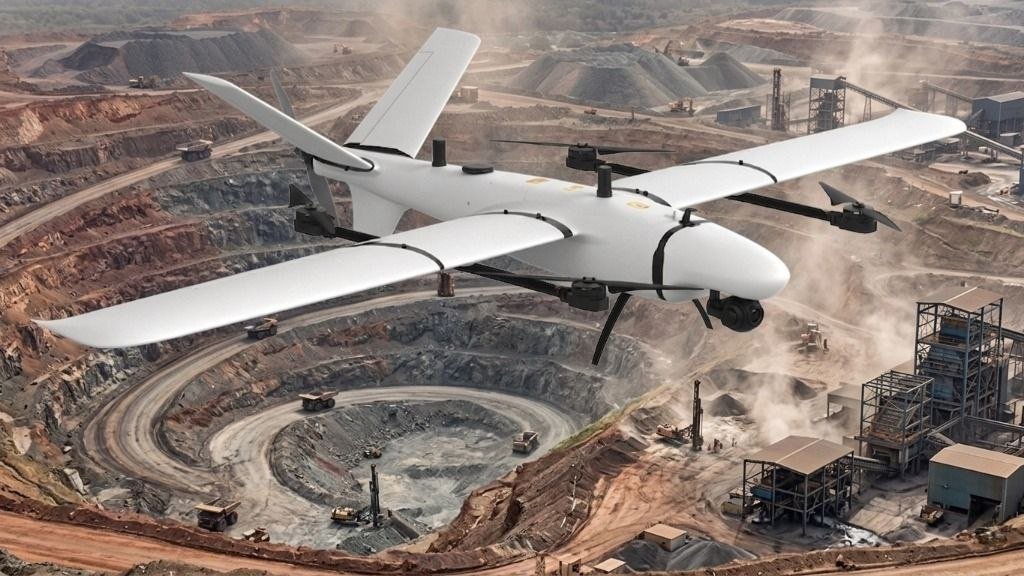
Surveying & Mapping
High-endurance VTOL capability for sub-centimeter orthophotos and volumetric models across vast land areas, construction sites, and mines.
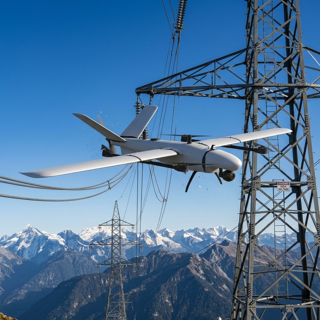
Infrastructure Inspection
Thermal and visual inspection of power lines, wind turbines, solar arrays, and bridges — eliminating rope-access teams and reducing risk to zero.
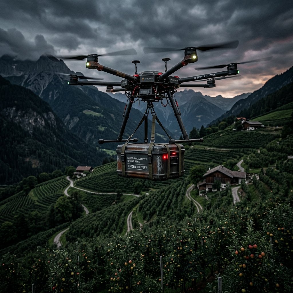
Remote Logistics
30kg heavy-lift capacity for last-mile delivery to remote communities and industrial sites unreachable by conventional road infrastructure.
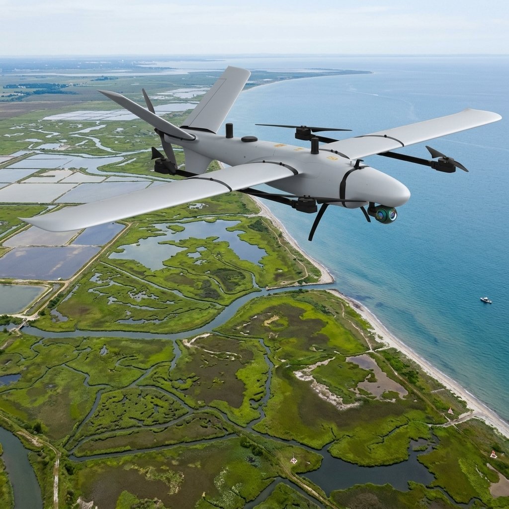
Environmental Monitoring
Coastal erosion tracking, wetland mapping, forest inventory, and wildlife habitat assessment over vast natural areas.
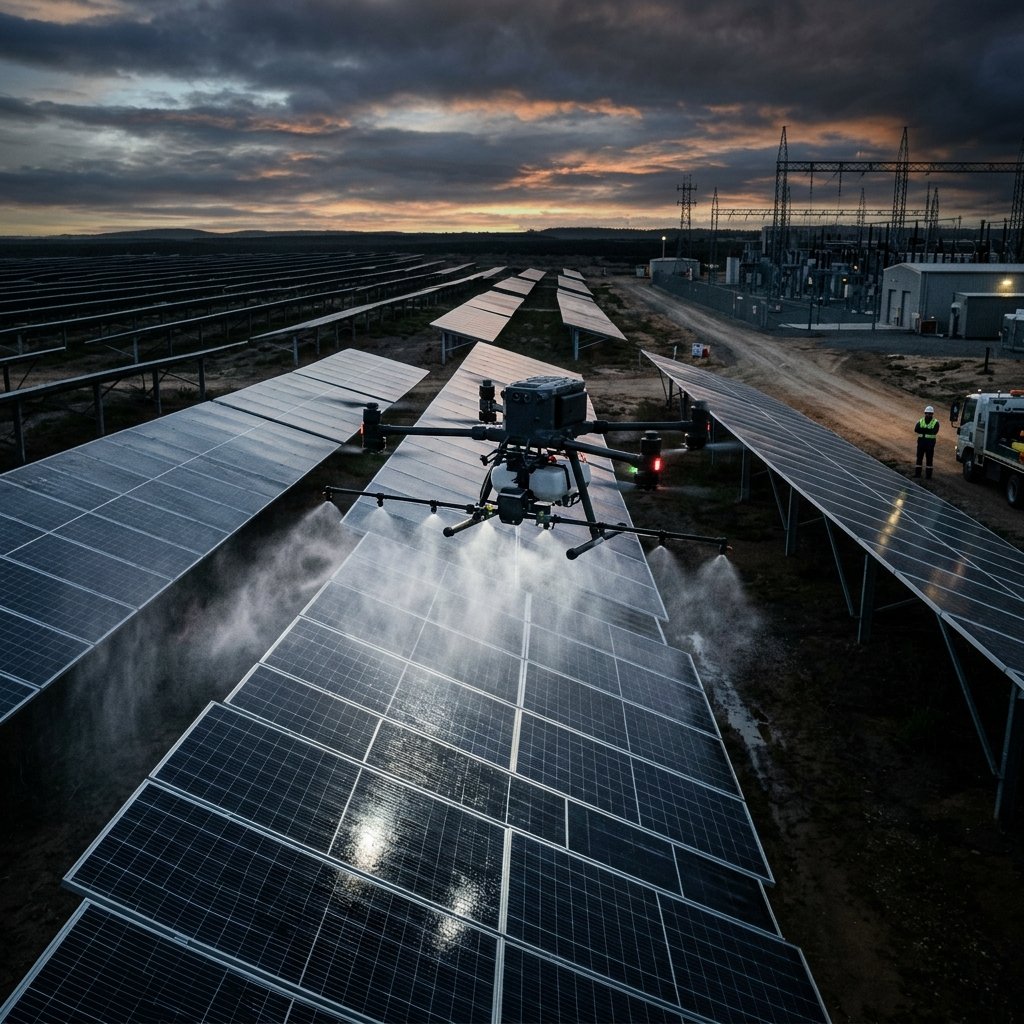
Solar Cleaning
Automated dry-brushing and high-pressure cleaning for utility-scale solar farms. Maximize energy yield without the water waste or human risk.
One Platform.
Infinite Applications.
A single platform engineered for rapid payload swaps — from precision agriculture to industrial logistics. Same drone, different mission, every time.
Liquid Spraying
30L tank · 8 nozzles · precision flow
Granular Spreading
40L hopper · variable rate · uniform spread
Heavy-Lift Delivery
30kg payload · quick-release · GPS-locked
Panel Cleaning
Dry brush · high-pressure · solar-safe
From Requirement
to Full-Scale
Operations.
 01
01Define the Mission
Our engineers work alongside your operational team to fully understand the environment, regulatory constraints, payload requirements, and mission objectives. No assumption. No compromise.
Site surveys · Regulatory mapping · Payload selection · Risk assessment
 02
02Configure & Deploy
Systems are assembled, configured, and rigorously tested against your specific mission profile before deployment. Field commissioning is handled end-to-end by our specialists.
System integration · Pre-flight certification · Field commissioning · Operator handover
 03
03Operate & Scale
With your team trained and operations underway, Aerial provides continuous support, firmware updates, and fleet expansion planning — ensuring your capability grows as your needs evolve.
Mission Critical SLAs · Remote diagnostics · Performance analytics · Fleet scaling
Manual Aerial Ops
Are Costing You
More Than You Know.
Every delayed survey, grounded inspection team, or missed spray window represents real revenue lost. Autonomous systems eliminate these friction points — permanently.
“Where human access ends,
autonomous systems begin.”
10× Faster Than Manual Methods
Autonomous aerial missions cover thousands of hectares in a single flight — completing in hours what traditional ground teams accomplish in days. Less time in the field means faster decisions and lower operational cost.
Always Mission-Ready
Proactive fleet diagnostics, modular hot-swap components, and remote firmware management eliminate unplanned downtime. Your aerial capability is available when the window opens — not when maintenance allows.
Data That Drives Action
Onboard AI transforms raw sensor feeds into decision-ready insights — crop stress maps, defect heatmaps, structural anomaly reports — processed at the edge before you've landed, not days later in a lab.
Ready to Deploy
Autonomous Aerial
Intelligence?
Our engineering team works with you from initial assessment through full-scale fleet deployment. No off-the-shelf answers — just solutions engineered for your operation.
Available globally · On-site & remote deployment · Certified operators